Those who are familiar with state parks as wooded areas surrounding a reservoir will not be prepared for the grandeur of Custer State Park. At more than 71,000 acres, it’s size would rank it among many national parks and is actually twice the size of the nearby Wind Cave national park. It is a must-do of the Black Hills region and preserves some of the most scenic spots in South Dakota. The most majestic of the granite peaks and breathtaking lakes are within the boundaries of the park.
Entrance to the park is similar to most national parks – a vehicle pass is $20 and good for a week. Annual passes were $36. Fee stations are situated at most park boundaries, but are not always manned. I would have loved to stay within the park, but cell service is spotty within its boundaries and I needed to do some working days. I really enjoyed my stay at Buffalo Ridge in Custer, and was close enough to be able to do evening hikes or drives.


Black Elk Peak Loop
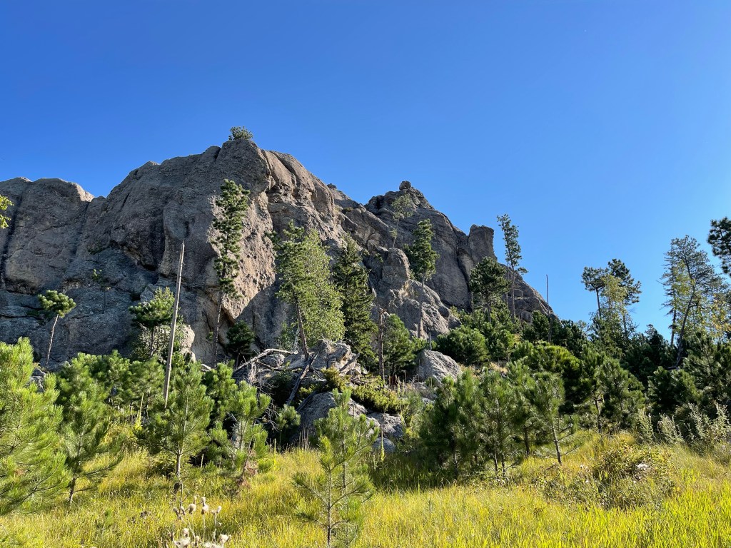
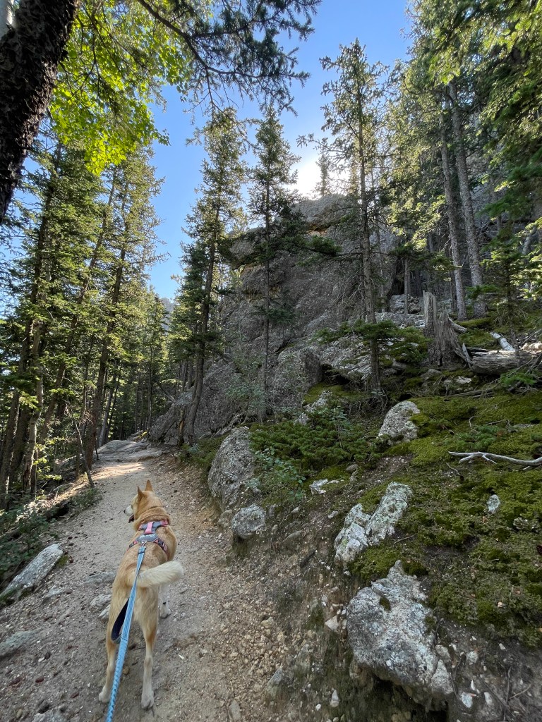
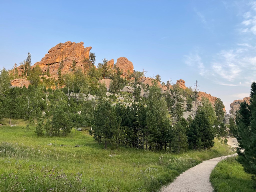
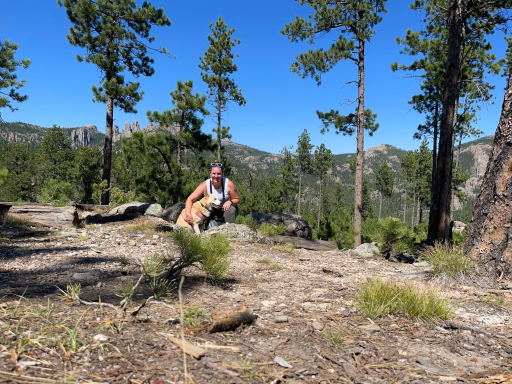
According to all the hiking apps and those who visited the area, the Black Elk Peak Loop is the must-do hike in the region. The hike clocks in between 7 and 7.5 miles depending on the source. The peak can also be reached by a slightly shorter out-and-back trail, but I am always a fan of a loop. More miles can be added to the loop by bagging Cathedral Spires or Little Devil’s Tower, but I knew I was pushing Blue’s endurance as it was and didn’t want to carry a 65 pound dog.
The main trailhead for this hike (and several others) departs from the Sylvan Lake parking lot. A smaller, less crazy lot is just up Needles Highway and might be a good option for very busy days.
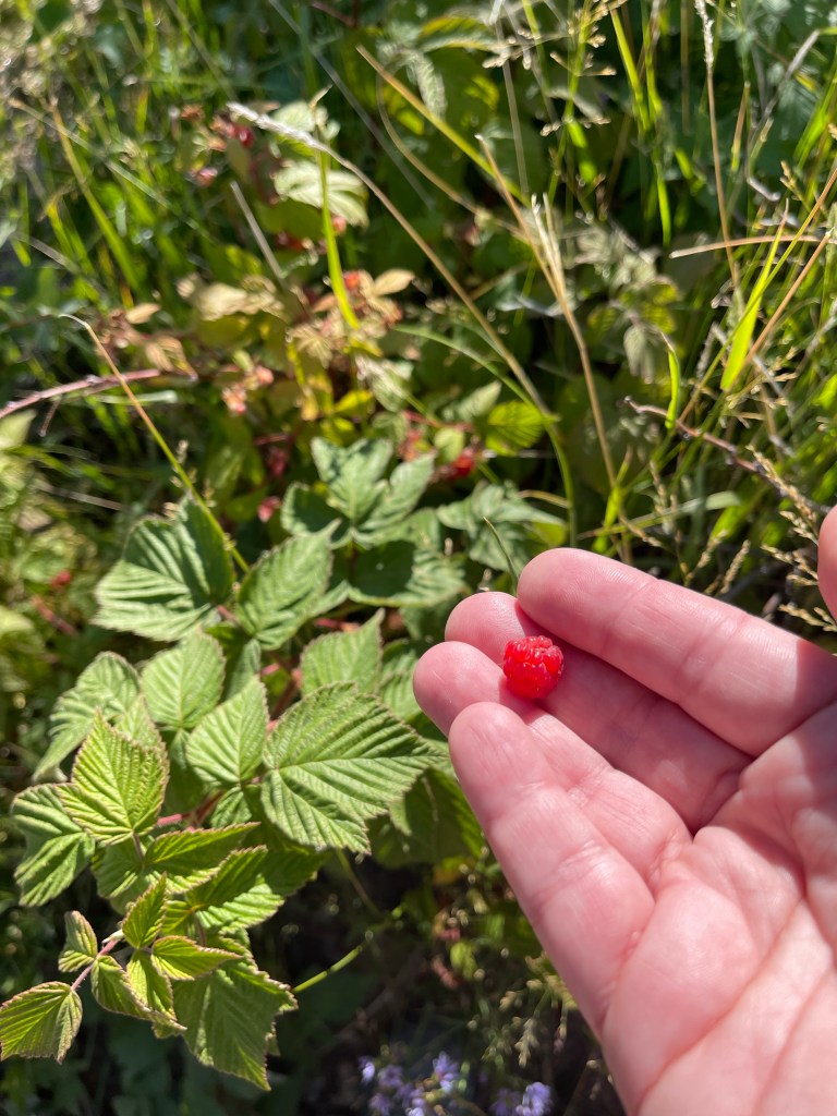
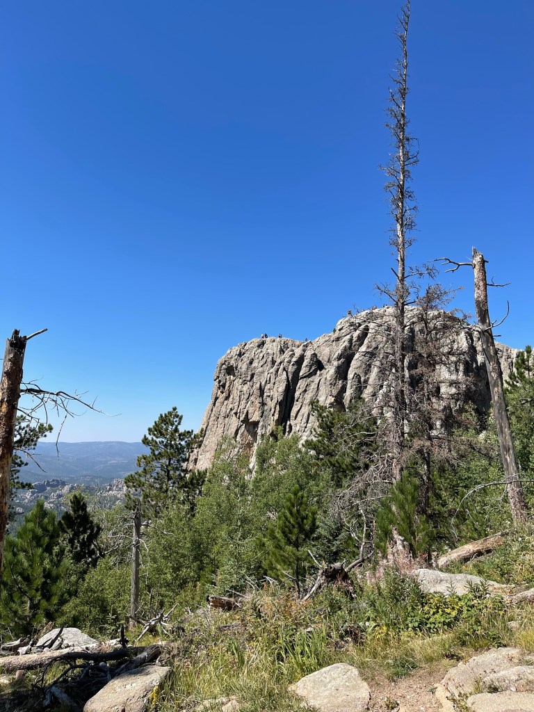
I hiked the loop counter clockwise and pretty soon I was walking through meadows, enjoying the early morning light shine off the surrounding granite peaks. At about 1 mile, you make your first climb, though it is not too steep. Trailside raspberries and spectacular views were adequately distracting. The third mile was my favorite mile of the trail as we traversed the backside of the spires and entered a dense shaded ponderosa pine forest.


At about mile three, the true climb begins. It is only about 600 feet of climbing in a little less than a mile for the final ascent, but the day was warm and this is about where Blue tapped out. Soon after we started going up the steps, she started seeking each patch of shade for extended breaks. If the shady spot was in the middle of the trail, hikers would just have to step over her. The final challenge was a metal grate staircase, one of Blue’s greatest fears. I think she was too hot and tired to refuse. It was rough going, but soon we were at the peak.


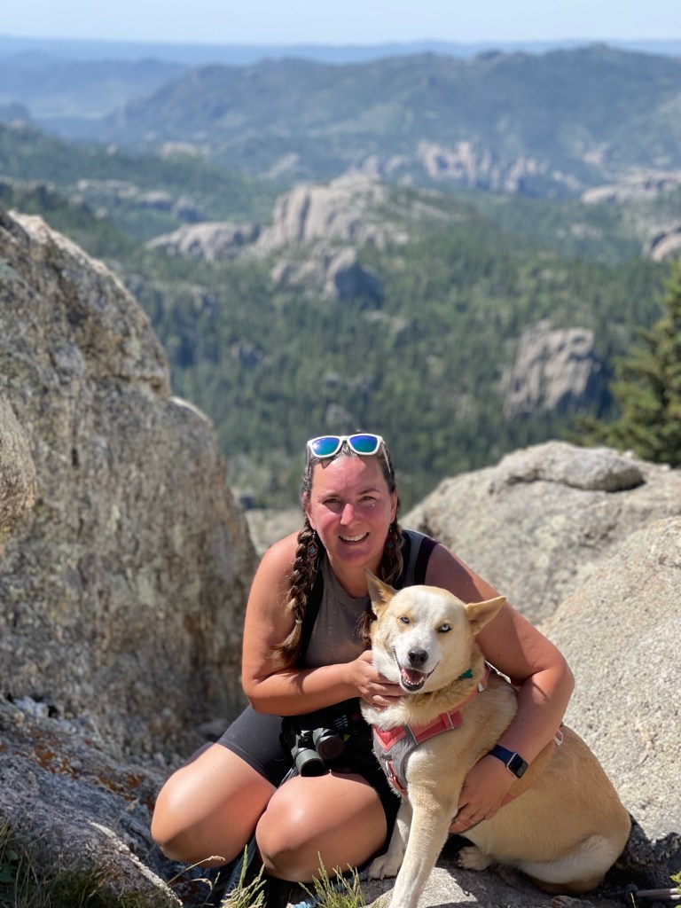
We chose to tackle this trail on the Saturday of Labor Day weekend, so we did not have the peak to ourselves in any way. However, we were able to find our very own patch of shade on the rocks as we enjoyed a snack and view of the surrounding Black Hills from the highest spot in South Dakota.
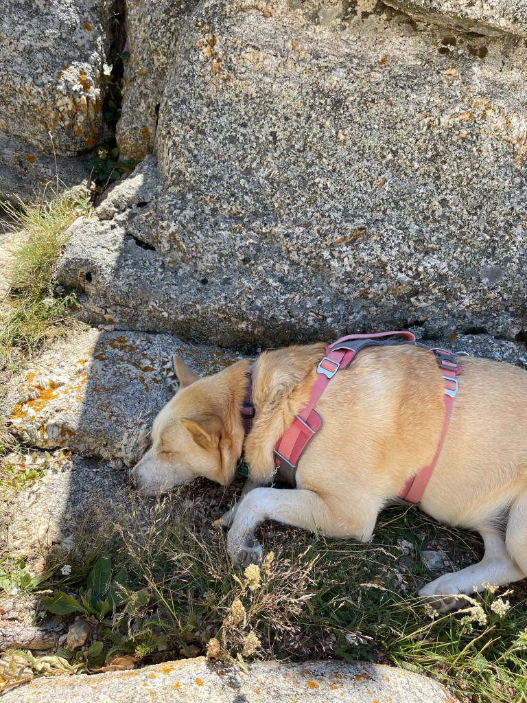
The descent was not much faster as Blue still shade hopped for frequent breaks. We were pretty continuously leapfrogging with an elderly solo hiker. Fortunately, at about mile five, the trail crossed the tiniest of streams. It was just enough for Blue to lie down, get wet, and drink her fill. This was clutch for the final two miles, especially since there was a final climb on the way back to the parking lot.


Alltrails rates this a moderate trail, and I basically agree. I would rate it a 6.5 or 7 on a difficulty scale of 10 which I guess makes it still moderate. But many less experienced hikers will find a 7+ mile trail with 1500 feet of elevation gain to be outside of what they want to attempt and that is plenty fair.
When we returned to the parking lot, it was as if a people bomb had gone off. The lake was solid with groups of paddlers, picnicers, and others enjoying the long weekend. Blue got to take a quick dip, but we were eager to get out of there quickly.
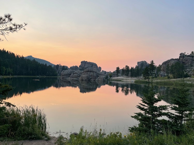
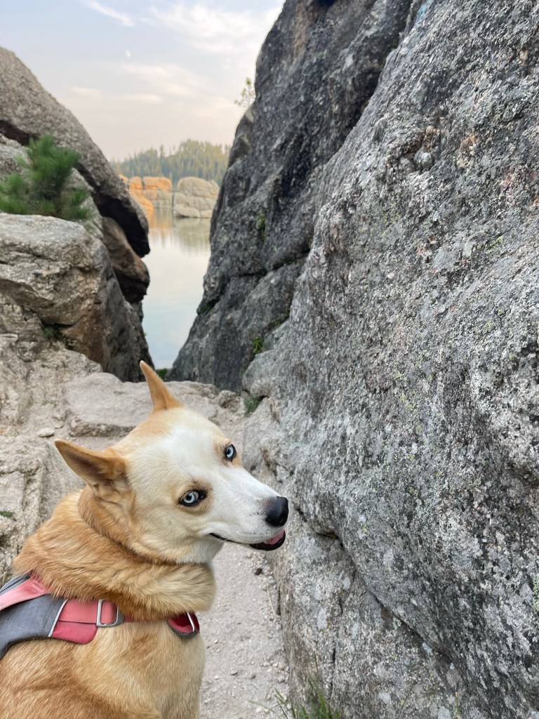
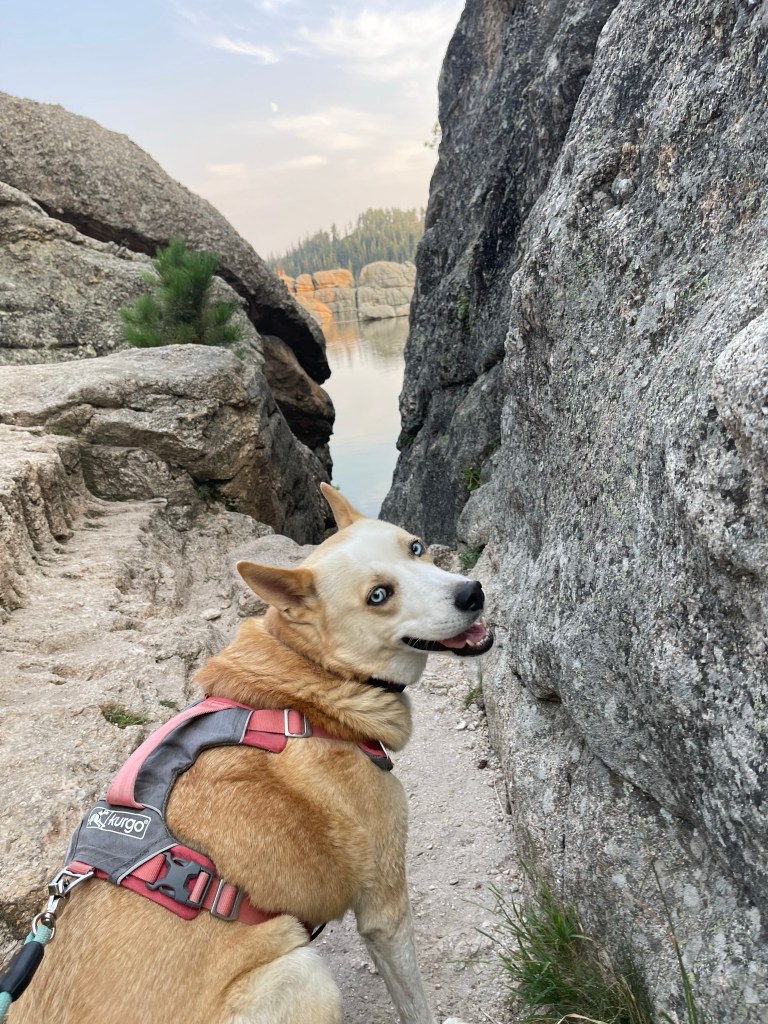
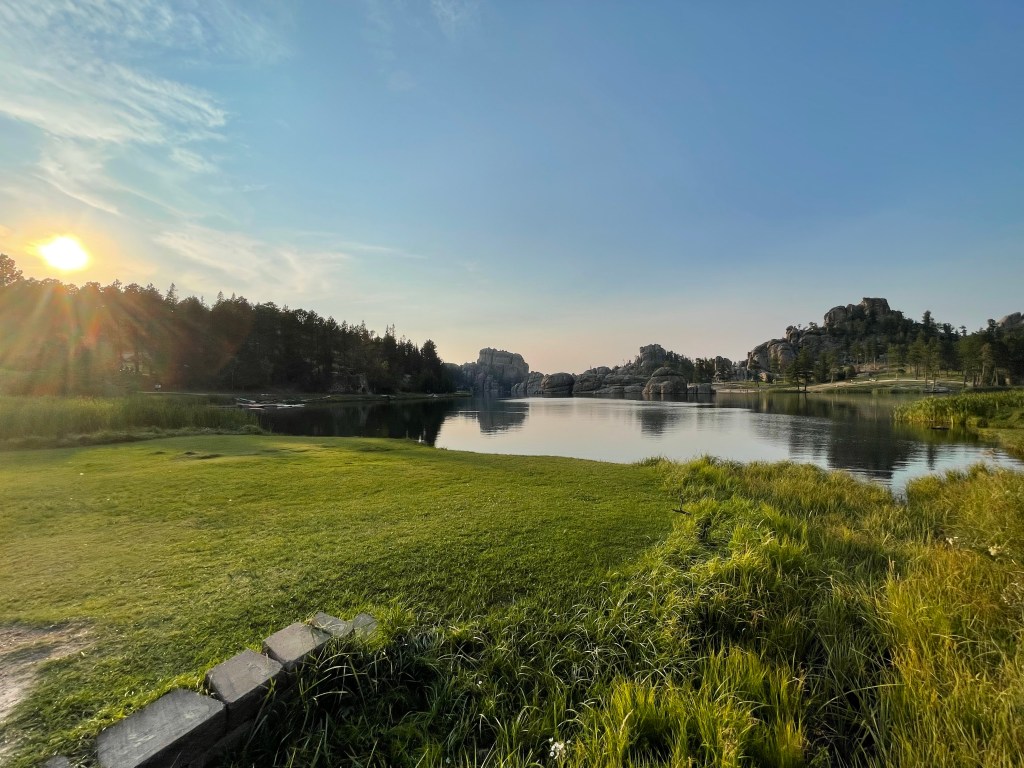
Sylvan Lake
Sylvan lake is a small reservoir tucked into the granite hills of the park. It is very popular with picnickers, swimmers, and paddlers on the weekend, but a visit early or late in the day can be a spectacular way to watch the colors of the sun unfold on the waters.
An easy mile-long trail follows the shore and would be a perfect walk for families.
I had really hoped to have time to do the Sunday Gulch trail, but wasn’t able to make it work this time. No matter how much time I give myself someplace, it seems there is always something more to do!
Needles Highway, Iron Mountain Highway, and Wildlife Loop
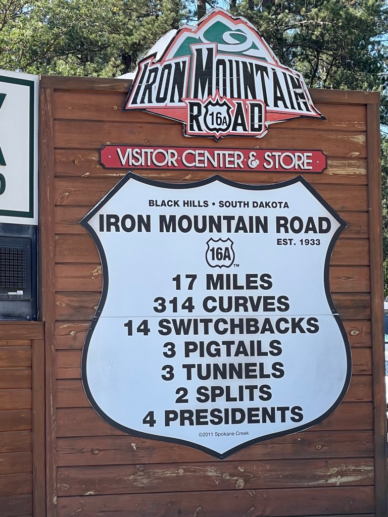
The Black Hills region is famous for its scenic drives and many of these are within Custer State Park. Part of the reason the area is popular for motorcycles is because there are so many spectacular rides in the region. At first it is tempting to just chalk up the great drives to the quality of the surrounding scenery, but it has to be noted that these are actually the brainchild of politician, visionary, and South Dakota salesman Peter Norbeck who in 1919 mapped the route of the Needles Highway to provide the best views. When the hired engineer was asked if such a route was possible, the response was, “If you can supply me with enough dynamite!”

It is even more remarkable when one realizes that each of the three tunnels on the Iron Mountain Highway perfectly frames Mount Rushmore.


The final jewel in the scenic drive crown of Custer is the Wildlife Loop. This takes you outside of the granite peaks into the rolling grasslands and is the prime spot for viewing pronghorns and vast herds of bison. Those on a mission to see the bison can stop into the visitor center for a tactical map of bison herd positioning. Blue’s favorite part of South Dakota can also be seen on the Loop. This is where she experienced her first prairie dog town. I think that up until this point she has never considered just how many “squirrels” might exist in the world as she has never seen more than a few at a time. Suddenly, hundreds of “squirrel” chirped at her from nearly every direction. It definitely blew her mind.

